I decided to acquire Cerulean Ridge because I thought that a better forest could reemerge on the site. The property’s history in the past 85 years shows how quickly the landscape can transition.
Present
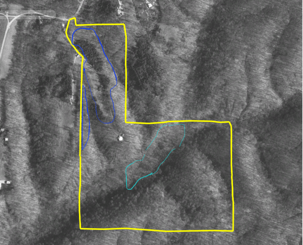
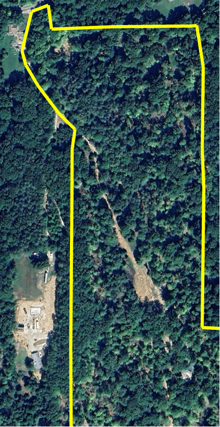
From above, the canopy is perceptibly thinner than in the surrounding forest. The patch of forest to the southwest (left) shows similar gaps in the canopy; it was previously under common ownership at the time of timber harvests. The soil is bare in the southeast and north-central areas where logs were skidded, sorted, and loaded.
Even so, Cerulean Ridge is likely at one of its most heavily forested points in the past 200 years.

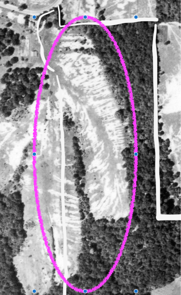
September 2023 image. Boundaries mapped by walking surveyed lines in December 2024 using GPS to capture coordinates for mapping. The southern and eastern boundaries with Morgan-Monroe State Forest had not yet been re-surveyed, so coordinates were logged from prior painted lines. The northeast corner post could not be located, resulting in a slight diagonal between boundary markers set on each line.
Europeans who settled in southern Indiana in the 1800s cleared the ridges and steep hillsides for subsistence farming, setting off significant erosion. The forested areas that remained were extensively harvested. By the 1920s and 1930s, the productivity of many of these farms had been exhausted. Private owners sold exhausted land to the federal and state governments, from which today’s public forests emerged. Much of the land was allowed to revert to hardwood forests through natural succession, while some highly eroded land was planted with pinus (pines) to stabilize depleted soils on which hardwoods could no longer grow.
1939
In 1939, aerial photography shows that land at and around Cerulean Ridge was cleared for active or recently abandoned farms on the ridgetops and in the creek bottoms. Clearings that followed topography created narrow “fingers” of forest; forest-field edges were extensive.

Note: Along the top of the photo, Bean Blossom Creek is undammed and winding through flat, bottomlands dedicated to agriculture. Lake Lemon will not be created for another 14 years.
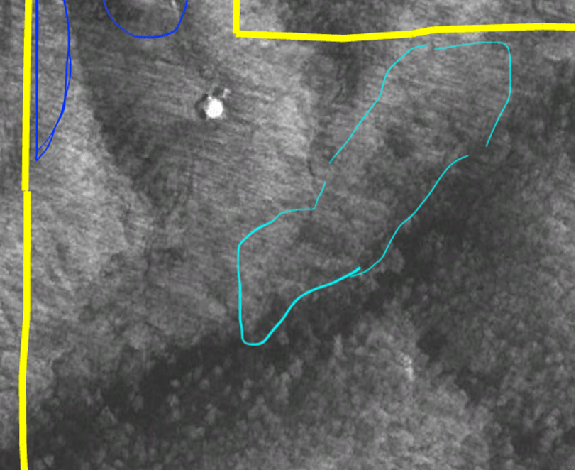
Zooming in, mature forest was much less common at Cerulean Ridge and surrounding areas. Reforested ridges/slopes are outlined in blue and cleared bottoms are in turquoise. Notably, none of the outlined fields appear to be in cultivation—contrast their appearance with the striped patterns in the small fields along the bend to the left or the field along the creek in the bottom left corner. Therefore, we can infer that they are likely pasture or, where they are studded with woody plants, likely abandoned fields that have begun to revert to forest. Areas that remain cleared in current photographs are not circled.
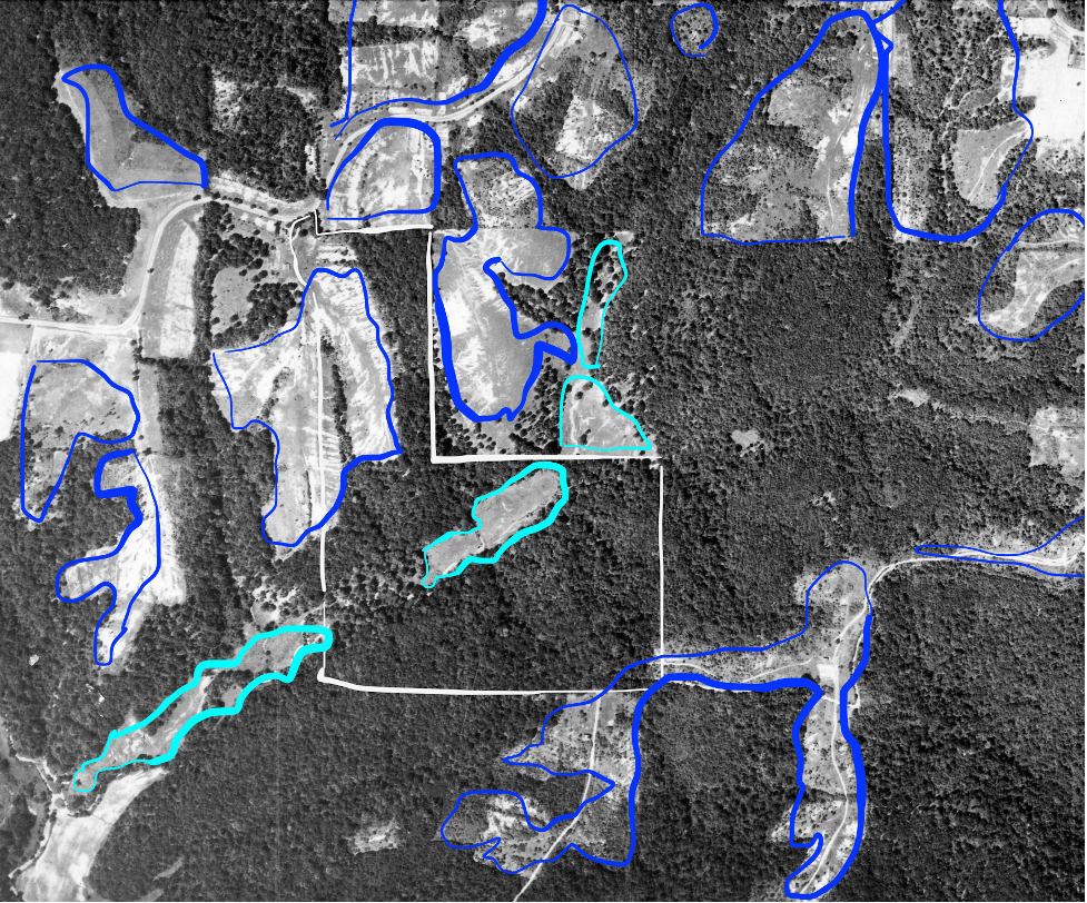
The soil structure itself appears to be visible in the aerial photographs. On various sites, serious erosion of the soil appears to show up in light/shadow patterns in clearings. These heavily eroded gullies are especially notable on the slopes in the northern portion Cerulean Ridge.
These eroded gullies are present on the landscape today, and I look forward to adding a picture soon. I could not identify any livestock in the pastures, though it is possible that some of the dots that I have assumed to be the foliage of woody species that are beginning to establish in the meadows are in fact livestock.
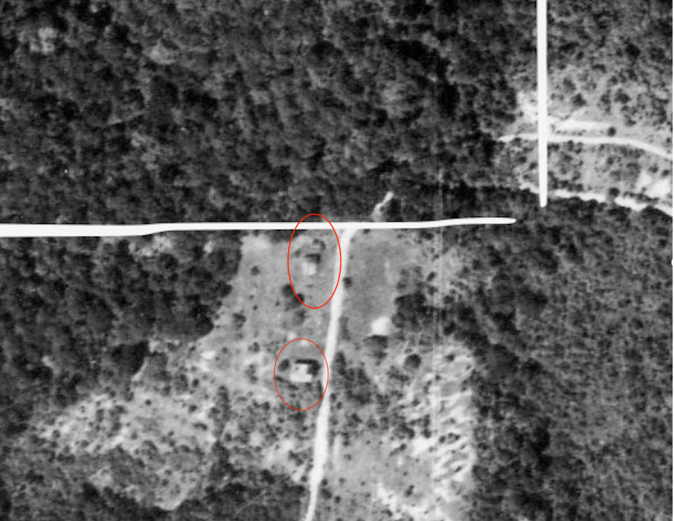
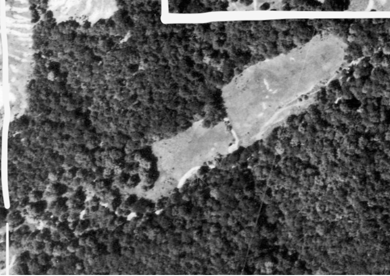
On the back ridge, just south of the current property line, there appear to be two or three buildings (red circles) on an abandoned farm whose pastures are in an early stage of succession to forest.
1954
Fifteen years later, a photograph in June 1954 shows a landscape that, in places, has begun a marked transition to forest across the landscape.
At Cerulean Ridge, the edges around the bottom fields have begun to become blurrier, suggesting they have been abandoned at some point after 1939 and have been allowed to begin reverting to forest.
The front ridge, however, does not show substantial succession from clearing to forest. It is unclear whether it was still being actively grazed or whether the soils were too depleted to support reestablishment of hardwoods.
Landscape Level
Cerulean Ridge

1967
An additional 13 years later, in October 1967, the property appears more clearly to have been abandoned from agricultural production—a trend which is becoming more evident across the landscape.

At Cerulean Ridge, even the center of the bottom fields has begun to fill with trees.
The front ridge has also begun to show blurrier edges with the forest, and woody species development appears to have begun over the heavily eroded areas. On a neighboring property, an eroded slope has been planted with a dense grid of pinus strobus (eastern white pine), circled in green.

At Cerulean Ridge, even the central area of the bottom fields has begun to fill with trees.
The front ridge has also begun to show blurrier edges to the forest, and woody species development appears to have begun over the heavily eroded areas.
1998
31 years later, in April 1998, the view from above is dramatically different. A dome home has been built at the southern point of the front ridge. The pattern of land use is definitively not agricultural, and the property has likely been deeded off from the original farmhouse at the road.
Former fields in the bottoms (teal) are visually indistinguishable from surrounding hardwood forest. Likewise, on the front ridge(s), upland old fields (blue) have changed dramatically. A smaller open area that appears to be a mowed meadow remains. On slopes along the ridges, there are two dense stands of pinus (pines) that contrast with the bare limbs of the hardwoods in early spring. And on the lower slopes of the main ridge—and on the western ridge—hardwood forest appears to again occupy areas that showed only the earliest signs of succession 31 years prior. On the back ridge, no evidence of the former farm to the south remains in an unbroken sea of forest.
A Closer Look
The rapid evolution of these sites provides hope that, in the coming decades, Cerulean Ridge’s current state can rapidly evolve toward richer forest.
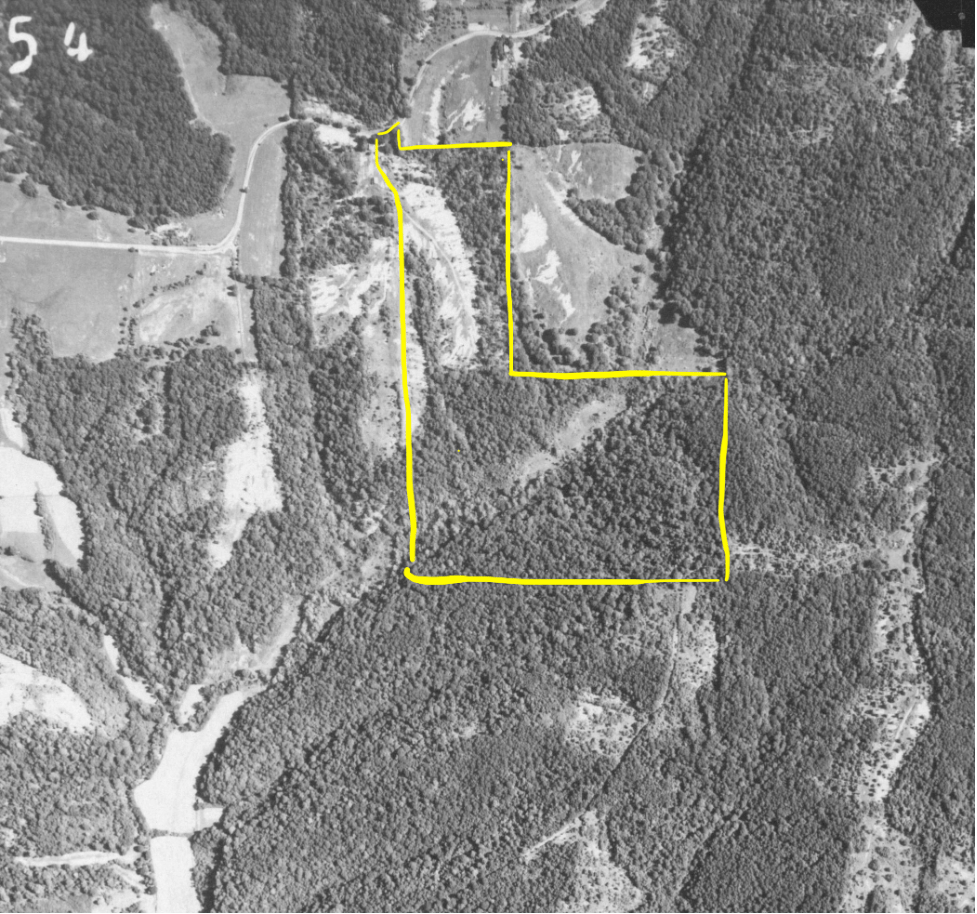
Abandoned Farm to the South—Incorporated into Morgan-Monroe State Forest
1939 to 1998
Within 59 years, old farm fields in an early stage of succession have reverted to forest that is indistinguishable from surrounding.
In the 28 years from 1939 to 1967, the fields appear to have substantially reverted, but have a more open canopy structure than surrounding forest areas. Notably, the fields appear to have been abandoned prior to 1939, and significant vegetation has begun to establish across the fields.
1939
1954
1967


1998
2023


Cerulean Ridge—Creek Bottom
1954 – 1998
In this 44-year period, old farm fields in bottom progress rapidly from a recently abandoned field to being indistinguishable to surrounding canopy. It is unknown at what point between 1939 and 1945 the fields were abandoned.
Interestingly, vegetation seems to have established more rapidly in some areas than others. In the 13 years between 1954 and 1967, there appears to be significant development of vegetation that was established in 1954, while other areas remain bare.
1939
1954
1967


1998
2023

Cerulean Ridge—North Hill
1939 to 1967
During this 28-year period, there is minimal succession of the cleared pasture to forest. Succession appears quite early in the 1967 photograph. We do not know whether the land was grazed or mowed during parts of this time, or whether the significant erosion delayed forest succession.
1939
1954
1967


1967 to 1998
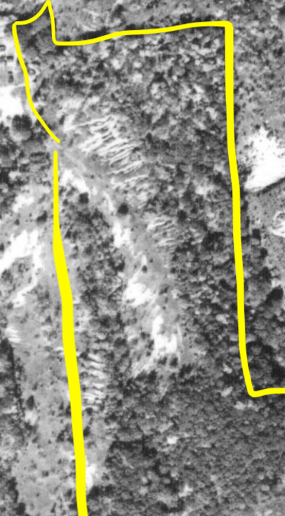
Over this 31 year period, a forest has become reestablished on most of the side slopes of the hill, with a small meadow apparently mowed along the top of the ridge. Approximately 3.5 acres at the top of the slopes where severe erosion occurred has been planted in pinus strobus (eastern white pine). The remainder of the slopes have regenerated in a hardwood forest that is not distinct from the surrounding forest while looking at the aerial photograph.
1998
2023

Reflections
The past 85 years’ indicate that a substantial forest canopy can reemerge from even bare fields within 30 to 40 years. This provides significant hope for the trajectory of Cerulean Ridge.
The appearance of canopy cover from an aerial photo does not tell the entire story. Walking through the forest over those decades, the ages and diameters of trees in various stands would likely have been noticeably different, with areas already forested in 1939 containing significantly larger and older trees that early and mid-successional fields. The aerial view also doesn’t tell us about the ecological diversity or value of the tree species that created the second forest canopy on former old fields. Nor does it give us insight into the quality of the herbaceous layer of the forest.
But foundationally, the past illuminates that natural processes point toward a more beautiful forest in the future—potentially with results on a much shorter timeline than required for cleared fields to regenerate. Aesthetically and experientially, the few clear-cut canopy openings created by recent logging are, at their largest, much smaller than the old fields of 1939. Elsewhere, there are residual trees that will continue to mature. Walking through the forest in a few decades, we should encounter a mixed-age forest that will look visually different than a single age-class regrowth on a bare field. The single age-class forest at Cerulean will be limited to small pockets where today there are clear cuts.
While much restoration remains to be done at Cerulean Ridge, the past shows a promising future.
Last updated January 31, 2025
